Thematic Exhibition主题展览

Seven sections across the full Digital Earth value chain: data acquisition, processing and analysis, and industry applications.围绕数字地球“数据获取—处理分析—行业赋能”全链条设置七大板块。

Exhibition Architecture展览架构

The exhibition is planned as a connected ecosystem rather than isolated product categories — linking satellite and ground infrastructure, spatiotemporal data and AI, urban and rural applications, marine technology, disaster reduction, and green development.展览强调贯通式产业生态:从卫星与地面基础设施、时空数据与人工智能,到城市乡村应用、海洋科技、数字减灾与绿色发展,形成相互连接的展示体系。

No.01 Session

Aerospace Information and Commercial Space Industry空天信息与商业航天产业

From satellite systems and ground infrastructure to aerospace information processing and industry applications.覆盖卫星系统、地面基础设施、空天信息处理与行业应用。

★ Satellite Systems and Ground Infrastructure★ 卫星系统与地面基础设施

Commercial communications, navigation, remote sensing and in-orbit computing satellites; payloads, components and materials; inter-satellite and satellite-to-ground links; mission operations and orbit simulation; satellite manufacturing, testing equipment and software. Ground systems include TT&C stations, gateways, receiving stations, data centers, antennas, calibration and validation networks, and data storage and management systems.商业通信、导航、遥感与在轨计算卫星;载荷、部组件与材料;星间与星地通信链路及终端;任务运行与轨道仿真;卫星制造、测试设备和软件。地面系统包括测运控站、网关站、数据接收站、数据中心、天线系统、定标与真实性检验网络、数据存储与管理系统等。

★ Advanced Materials and Core Components★ 先进材料与核心部组件

Ultralight high-strength composites, high-temperature and radiation-resistant materials; space-grade radiation-hardened chips, precision star trackers, Hall thrusters, gallium arsenide solar cells, high-reliability sensors, precision antennas and servo actuators.超轻高强复合材料、耐高温合金、抗辐照材料;宇航级抗辐照芯片、高精度星敏感器、霍尔推力器、高效砷化镓太阳能电池、高可靠传感器、精密天线与伺服执行机构等。

★ Aerospace Information Processing★ 空天信息处理

Batch processing, high-performance and AI computing systems, standard and higher-level data product generation, rapid-response processing pipelines and data distribution systems.空天信息批处理、高性能与AI计算系统、标准及高阶数据产品生产、快速响应处理流水线与数据分发系统。

★ Aerospace Information Applications★ 空天信息应用

Satellite communications, GNSS and remote-sensing terminals and platforms; data and software products; integrated communication-navigation-remote-sensing solutions; space-air-ground integration; data storage, processing, cloud services and API demonstrations; applications for emergency management, surveying, GIS, agriculture and ecosystem monitoring.卫星通信、GNSS与遥感终端及平台;数据与软件产品;通导遥一体化与空天地一体化解决方案;数据存储处理、云服务与API演示;以及面向应急管理、测绘地理信息、农业、生态环境监测等行业的综合应用。
No.02 Session

Core Digital Earth Technologies and Platforms数字地球核心技术与平台

The digital foundation: Earth system simulation, spatial AI, GIS software, spatiotemporal computing and cloud services.聚焦地球系统模拟、空间智能、GIS核心软件、时空计算与云服务等数字底座。

★ Digital Earth Systems and Earth System Simulation★ 数字地球系统与地球系统模拟

Digital Earth science and engineering; digital twins of the Earth; Earth system models and numerical simulation; virtual environments; coupled modeling of land surface, climate, ecosystems and hydrology; and models for Sustainable Development Goal indicators.数字地球科学与工程、地球数字孪生、地球系统模型与数值模拟、地球环境虚拟仿真、陆面—气候—生态—水文耦合建模,以及可持续发展目标指标计算与评估模型等。

★ Spatiotemporal Big Data and Artificial Intelligence★ 时空大数据与人工智能

Aerospace big-data governance and retrieval; spatiotemporal databases and data lakes; AI interpretation and large models for remote sensing; multisource data fusion; spatiotemporal knowledge graphs and spatial AI agents; training frameworks, sample datasets, annotation and quality control.空天大数据治理与检索、时空数据库与数据湖、遥感影像AI解译与遥感大模型、多源异构数据融合、时空知识图谱与空间AI智能体、深度学习训练框架、样本数据集、数据标注与质量检查等。

★ GIS Core Software and Location Intelligence★ GIS核心软件与位置智能

Core GIS platforms, remote sensing and photogrammetry software, spatial analysis and modeling tools, map engines, navigation and positioning services, 3D reality modeling, spatiotemporal visualization and digital-twin engines.GIS基础平台、遥感与摄影测量软件、空间分析建模工具、地图引擎、导航定位服务、三维实景建模、时空数据可视化与数字孪生引擎等。

★ Spatiotemporal Computing and Cloud Services★ 时空计算与云服务

Spatiotemporal cloud platforms, remote-sensing cloud computing, AI computing centers, liquid-cooled server rooms, distributed storage, edge nodes, and services for open sharing and trading of aerospace data.时空信息云平台、遥感云计算服务、AI计算中心、液冷机房、分布式存储、边缘计算节点,以及空天数据开放共享和交易服务等。

No.03 Session

Digital Cities and Territorial Spatial Planning数字城市与国土空间

Reality modeling, spatial planning governance and applications for safer, lower-carbon urban development.以实景三维、国土空间治理和城市可持续发展应用服务城市全生命周期。

★ 3D Reality Modeling and Next-Generation Base Mapping★ 实景三维与新一代基础测绘

Oblique photogrammetry, LiDAR, next-generation base mapping, city information modeling (CIM), city-brain and urban operations platforms, and underlying spatiotemporal data infrastructure.倾斜摄影、激光雷达、实景三维数据采集与建模、新型基础测绘产品与服务、城市信息模型(CIM)、城市大脑与城市运行管理平台,以及底层时空数据基础设施。

★ Digital Governance of Territorial Space★ 国土空间数字治理

Integrated one-map systems for spatial-plan implementation, cultivated-land protection, natural-resource inspections, unified rights registration, ecological redline monitoring and land-use change surveys.国土空间规划实施监督“一张图”、耕地保护与自然资源督察、自然资源统一确权登记、生态保护红线监测、国土利用变化遥感监测等。

★ Sustainable Urban Development Applications★ 可持续城市发展应用

Urban assessment and renewal; monitoring of bridges, pipelines, gas networks and geological-risk slopes; urban flood simulation and sponge-city stormwater management; urban carbon-emission monitoring and management.城市体检与更新,桥梁、管线、燃气网络及地质灾害边坡等关键基础设施安全监测,城市内涝模拟与海绵城市雨洪管理,城市碳排放监测与管理等。

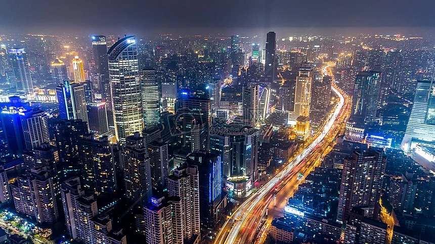
Wuhan urban landscape
No.04 Session

Digital Villages and Smart Agriculture数字乡村与智慧农业

Remote sensing, BeiDou precision agriculture and rural spatiotemporal infrastructure for resilient food systems and rural development.以遥感、北斗精准农业与乡村时空信息基础设施服务粮食安全与乡村发展。

★ Agricultural Remote Sensing and Crop Monitoring★ 农业遥感与作物监测

Crop growth monitoring and yield estimation, cropping-pattern mapping, planted-area measurement, soil-moisture retrieval, pest and disaster warning, satellite agrometeorology and spatiotemporal big data for food security.作物长势监测与估产、种植结构识别与面积测量、土壤墒情遥感反演、病虫害与农业灾害监测预警、卫星农业气象服务及粮食安全时空大数据等。

★ BeiDou Precision Agriculture and Smart Farms★ 北斗精准农业与智慧农场

BeiDou-enabled autonomous machinery, coordinated unmanned fleets, variable-rate fertilization, precision irrigation, remote supervision of farm operations, agricultural big-data platforms and quality traceability.北斗赋能农机自动驾驶、无人农机集群协同作业、变量施肥与精准灌溉、农机远程监管、农业农村大数据平台、农产品质量追溯等。

★ Rural Spatiotemporal Information Infrastructure★ 乡村时空信息基础设施

Rural 3D reality modeling, digital management of homestead land, digital-village one-map platforms, rural environmental monitoring, smart water management and irrigation-district digitalization.乡村实景三维、宅基地数字化管理、数字乡村“一张图”、农村人居环境监测、智慧水务与灌区数字化等。

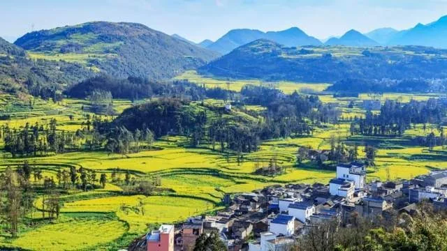
Rural landscape
No.05 Session

Digital and Intelligent Marine Technology and Equipment数智海洋科技装备

Observation, exploration, intelligent equipment and digital-ocean applications for sustainable marine development.涵盖海洋观测探测、智能装备,以及数字海洋与可持续发展应用。

★ Marine Observation, Exploration and Intelligent Equipment★ 海洋观测、探测与智能装备

Marine satellite remote sensing, surface buoys, subsurface moorings, underwater robots, unmanned vessels, marine surveying, geophysical exploration, smart ships and shipping digitalization.海洋卫星遥感与应用、海面浮标与水下潜标观测网、水下机器人与无人船、海洋测绘与地球物理探测、智能船舶与航运数字化等。

★ Digital Ocean and Sustainable Development Applications★ 数字海洋与可持续发展应用

Marine big data, forecasting and warning, ecosystem and blue-carbon monitoring, marine ranching and smart fisheries, polar ice and snow remote sensing, marine carbon-sink measurement, and digitalization of ports and marine engineering.海洋大数据与预报预警、海洋生态与蓝碳监测、海洋牧场与智慧渔业、极地冰雪遥感、海洋碳汇测量、港口与海洋工程数字化等。

No.06 Session

Digital Disaster Reduction and Sustainable Development数字减灾可持续发展

Space-enabled monitoring, early warning, emergency communications and digital contingency capabilities.聚焦空天灾害监测预警、应急通信与数字化应急能力。

★ Aerospace-Enabled Monitoring and Early Warning★ 空天赋能自然灾害监测预警

InSAR ground-deformation monitoring, flood and drought remote sensing, forest and grassland fire monitoring, typhoon and heavy-rainfall nowcasting, earthquake emergency assessment and rapid disaster mapping.InSAR地表形变监测、洪涝与干旱遥感监测、森林草原火灾卫星监测、台风和强降雨临近预报、地震应急评估与灾害快速制图等。

★ Digital Equipment and Services for Emergency Management★ 应急管理数字装备与服务

Emergency satellite communications and BeiDou short messages; UAV reconnaissance and communication support; urban safety-risk monitoring and warning; digital emergency plans and simulation exercises; disaster prevention for cultural heritage.应急卫星通信与北斗短报文、无人机应急侦察与通信保障、城市安全风险综合监测预警、数字化应急预案与仿真演练、文化遗产防灾减灾等。

No.07 Session

Green and Low-Carbon Development and the Digital Belt and Road绿色低碳与数字“一带一路”

Remote sensing for carbon and ecosystems, green finance, and international aerospace cooperation for sustainable development.围绕碳与生态遥感、绿色金融,以及面向可持续发展的国际空天合作。

★ Carbon Neutrality and Ecosystem Monitoring★ 碳达峰碳中和与生态监测遥感

Greenhouse-gas satellite monitoring, carbon-sink measurement and accounting, carbon-footprint spatiotemporal data, MRV platforms, ecosystem and environmental-quality remote sensing, biodiversity surveys and ecological-restoration assessment.温室气体卫星监测、碳汇测量与核算、碳足迹时空大数据、碳排放监测报告核查(MRV)平台、生态环境质量遥感、生物多样性调查监测与生态修复成效评估等。

★ Green Finance Services★ 绿色金融服务

Green and transition finance institutions, carbon-market services and data products, climate investment and financing, ESG assessment and green supply-chain finance.绿色金融与转型金融机构、碳市场服务与数据产品、气候投融资、ESG评价与绿色供应链金融服务等。

★ International Aerospace Cooperation for the Digital Belt and Road★ 数字“一带一路”国际空天合作

Overseas BeiDou, remote-sensing and communications services; global land-cover and sustainability monitoring products; satellite solutions for disaster monitoring, crop estimation, resources and environment; SDG satellite results; Digital Earth capacity-building and cooperation projects for developing countries.北斗、遥感与通信卫星海外应用服务,全球地表覆盖与可持续发展监测产品,面向共建国家的灾害监测、作物估产、资源环境等卫星应用方案,可持续发展科学卫星成果,以及面向发展中国家的数字地球能力建设与合作项目。

★ Science and Engineering Applications for Improving Eco-Environmental Quality★ 改善生态环境质量的科学与工程应用

Prevention, control and remediation of air, water and soil pollution; solid-waste disposal and resource recovery; and control of physical pollution such as noise, radioactive substances, light, heat and electromagnetic waves.大气污染、水污染和土壤污染的防治与修复,固体废物处置与资源化,以及噪声、放射性物质、光、热、电磁波等物理性污染防治。

Interested in exhibiting?有意参展?

Tell us your technology, product or application area and we can connect it with the relevant exhibition section.告诉我们您的技术、产品或应用方向,便于后续对接相应展览板块。